
I had a snowshoe planned toward the end of the month. It was right after another good dose of snow. I’d never snowshoed in Kings Canyon, so we settled on the Park Ridge Trail.
The trailhead was somewhere past Wilsonia and the visitor center, but I didn’t really load a map before losing cell service. Many roads were unplowed, so we gave up finding the particular trailhead and just parked near the visitor center.
The Park Ridge Trail is east of the visitor center, and runs from north to south. Our plan was to hike east, and hopefully run into it. All we had was the flat AllTrails app map, no topo. It highlighted the trail and our GPS location, but we had no idea how many mountains and ridges were between us. It sounded fun. ☺

Near the visitor center
There were snowshoe tracks from the visitor center leading north to the Crystal Springs Campground. It was beautiful seeing campsite markers every so often, although most of the campground identifiers were covered in snow.

Stunning!
We started to head east on the path of least resistance, which was slightly southward as well. There really wasn’t a good way to cut straight east, so we ended up going parallel to the trail we were trying to get on.

Few ice bridges
We came upon an old phone booth covered in snow. It didn’t work. Either that, or no one wanted to talk to me.

Hello?
We started seeing cottages, and thought they must be part of the campground. Little did we know, we were already south of our starting point and in Wilsonia. It was really cool to be strolling down snow-covered streets in a deserted neighborhood.

Crystal Springs Campground
At the end of the road and past the last house, we went down and hill and ended up at a creek too wide to jump across. There was a fallen tree that looked barely wide enough for a snowshoe. I used to have great balance as as gymnast. But in that moment, I had weak ankles from several past breaks and sprains, a weighted daypack, and snowshoes on. My balance isn’t any good these days.
Crossing over was OK, just a little scary. I was already dreading the way back.
Are you ever hiking, and you see a clearing beyond trees? You think, “Oh, that must be it! That’s the end where the trees open up and you get a great view!”
That’s what we saw coming up the hill on the other side of the stream.
And then you hike to that point, realize it’s a false peak, and you have to keep going.
It’s annoying. We got to where the trees appeared to part, but it wasn’t a view. In fact, there were clouds blocking whatever ridge was before us.
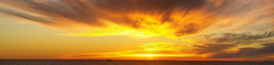
We decided the hike should end soon. We turned due south, and headed up the steepest hill yet. There was a decent view of nearby mountains, but most of the view was blocked by clouds and fog.

Best view of the trip!
We found a flat spot for a sit, a snack, then I proceeded to get chilly.
The snowshoe down was fun. It was steep, the snow was getting a little slushy, and sliding down a mountain was a real possibility. Weeeeee!
We got to the dreaded stream crossing. I started having flashbacks to a climb I did back in October. I was 1000 ft off the ground, and was supposed to jump across a 2 foot gap between rock columns. My climbing partner had to coax me across like a child. This stream crossing had an incredibly lower death potential, but YOU try telling your fears to be rational! ☺
I put one snowshoe on the slick, snowy tree, then leapt across the rest of the way. PHEW.
We started back the way we came, but I knew our initial hike was done in an extremely roundabout way. We were retracing our steps in Wilsonia when we saw a few cars parked in the distance. We thought about heading toward them, but we thought our car had to be farther north. It took a good 2 hours to snowshoe out to our “mountain,” so there’s no way 20 minutes would get us back to the car.
When our snowshoe prints cut away from a road and headed very far north, I decided we should take the road west. It’s bound to lead somewhere near the visitor center.
Sure enough, we saw the lodge a minute later, then found our way to the parking lot. A few spaces down from my car were the cars we saw earlier. We got so much unnecessary mileage in! 😂
Once home, I loaded the topo and figured out our trail. There was absolutely no way we would have ever made it to the Park Ridge Trail. Our “mountain” was just south of Wilsonia. The real trail is in red, our approximate trail is in yellow.

Oh, well. 🙂
While we were WAAAAAY off from our original plan, I wouldn’t necessarily call it a failure of a day. That’s big for me to admit. For those into personality types, I’m mostly an ISTJ. If I say I’m going to hike the Park Ridge Trail, I’m going to be true to my word and hike the Park Ridge Trail. It’s very hard for me to stray from a plan once it’s made because I hate “bailing” or “flaking out.”
I felt OK admitting that even though the plan didn’t pan out and the original end goal wasn’t reached, it was still a beautiful day in nature and the best way to spend my time.
Well Heyyyyyyyyyyyyyyyyyyyyyyyyyyyyyyyyyy😊😊Lauren once again really enjoy these pictures and reading what you have say about trip crystal springs beautiful and ice bridge 😊😊can’t wait for next one really enjoy you picture and reading about trip you right even if get end goal it never wasted trip 😊😊I love mountain too thanks Lauren 😊😊see you and guys sunrise and midday 😊😊