
I only make it up to that area once a year, if that. It’s a three hour drive, and a third of it is on a crumbly, cliffside, one lane road.
I’ve hiked out of Mono Creek before, but I decided to try a different trailhead that leads to Margaret Lakes. This time, I would hike out of the Onion Springs Trailhead.

Foothill penstemon
There wasn’t much information online, except for a few blogs from years ago. The trail wasn’t listed on the AllTrails app, and the Forest Service only listed coordinates of the lakes. With the blogs and signage I assumed would exist, I figured I’d easily find the lakes. Ha.
A note before continuing…
I typically try to insert photos near their corresponding part of the story in chronological order. I took 99% of my photos after this hike, so I will randomly put them in to break up my long-winded paragraphs. No organization to this day or blog, whatsoever.

Lake Thomas Edison
The road leading to the trailhead from Edison Lake is 4×4, and I found it pretty easily. It’s a few miles long, and I was going to push my Subie as far as I was comfortable doing before pulling over to hike the rest of the road. The blogs from 5-10 years ago said most SUVs should be able to make it, so I hoped my AWD and high clearance would be enough.
It wasn’t, but I expected that the road had likely deteriorated over the years. I watched a truck and Land Rover slowly struggle ahead of me. After gunning it up one last rock, I decided to pull over before I did something really dumb 😄. Subarus aren’t meant to be rock crawlers.
We were still a good 2-3 miles from the trailhead. We started hiking, and eventually passed the two struggling vehicles that had been in front of me. I was glad I pulled over when I did, but that was the only time that day that I felt like I made a good choice.

View from the 4×4 road.
The blogs said the trailhead was at the end of the 4×4 road. About .10 miles from the end, a truck was parked. Across from it was a broken and empty bulletin board. I walked over to it, saw that it was blank, and continued on. I thought the owner of the truck was obviously parked there for the camping spot, and was hiking out of the real trailhead at the end of the road.
The road ended a moment later at another broken and blank bulletin board. But this one had an obvious trail continuing through a metal gate. Out of the two bulletin boards, this was obviously the one to use. Or so it seemed.
Not long after passing through the gate, we encountered another broken sign. About 25% of it still existed, and it probably used to say “Sierra National Forest.” What is it with this area? The Mono Creek Trailhead I’d used for Graveyard Lakes had great signage with trail markers and mileage. This neighboring area seemed like the forgotten family member.

The ONE sign.
We walked a couple of miles through the woods, on what looked like an old forest service road. There was recent evidence of horses, and I figured there wouldn’t be pack animal use unless this trail led to somewhere cool.
I kept checking my cached Google map, and the trail was pretty far west from the lakes we wanted to get to. Each mile curved slightly more west away from the destination. We hoped there would be a trail junction that would take us east, but around 7 miles from the trailhead, we knew we should have been at the lakes.

Find a rock teepee, take a photo.
We considered trying to cross-country east, but there were ridges and gullies that would likely lead to impossible bush-whacking. No thanks. We turned around.
It was disheartening to drive all that way and to never make it out of the woods for a view or a lake. It was hot, and a swim was now out of the question.
I tried to keep my spirits up and chalk it up to being a nice 19 mile walk in the woods. But I was annoyed. I knew I probably wouldn’t make it back out that way until next year. It was a waste of 6 driving hours, 6ish miles of a 4×4 road on foot, and just a waste of a Saturday in general. Where the heck was the real trail?
On the way back, we looked to the east for a side trail that would lead to the lake. There was nothing.

Lake Thomas Edison
We passed back through the gate and knew our last hope was the other broken bulletin board. I walked back to it, hunted around, and finally noticed a very faint and discreet trail. I went down it a few yards, and saw in the distance an intact Sierra National Forest sign. You’ve got to be kidding me.
I wandered down a little more and encountered a mileage sign. I dont think it specifically mentioned Margaret Lakes, but I knew this was it. AAAARRRRGGGGG!
We hiked back out to the 4×4 road. We happened to look up when we reached the road. High above our heads was a tiny sign the same width and color as the tree it was nailed to. It said “trail.” I don’t know who notices a blended in sign way above eye level like that, but there it was. It almost made me even more annoyed that vague signage existed.

Sunset from the lake.
I can only assume that “trail” meant the trail we wanted. I gave up on staying positive and seeing the day as a nice stroll in nature. I was beyond aggravated, and wanted to throw a temper tantrum. I was so relieved to make it back to the car.
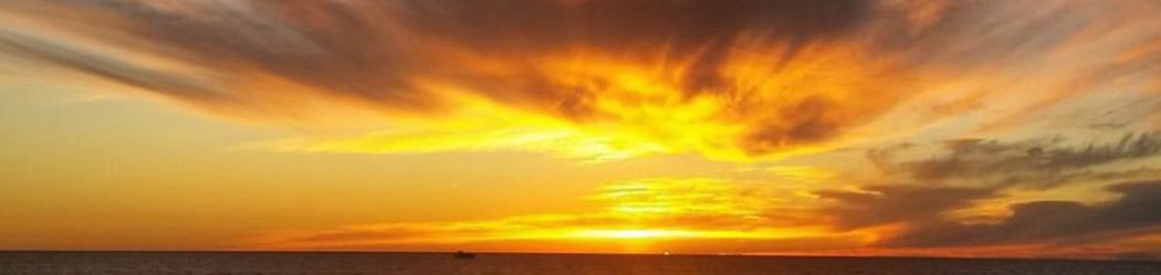
The sun was getting low in the sky by the time we drove past Edison Lake. A few clouds were in the sky, and at least that part of the day was beautiful.
We drove to the lookout at the dam to catch the sunset. It was amazing!

Sunset 😍

Sunset
There was quite the colorful display after sunset on the drive out of the mountains. Little did we know, the red glow and vibrant colors were likely due to the newly-reported Ferguson Fire. At that point, it had been burning for almost 24 hours, a firefighter had lost his life, and smoke was impacting the Valley and mountains. It would be another 6 weeks before the fire became contained.

Possibly pyrocumulus! Do you see the dragonflies?

Ferguson Fire colors.
When I got home, I did a new Google search on the trail to see where I went wrong. I pulled up the most recent blog I could find, which was from 2016. One of the first pictures was a group photo in front of a very informative bulletin board. There was a huge map behind them of the area, hiking tips included, and the bulletin board glass was intact and uncracked. Seems like a lot happened to the area in the last couple of years, and I wonder if it was vandals. Does the Forest Service not have the funds to maintain basic signs? Does anyone know if they accept volunteers or donations for signs? I want to fix this so this doesn’t happen to anyone else.

Sun near the boat ramp.
I will say that I overlooked a detail in one of the blogs – they mentioned the trail started at the clear signs on the NORTH side of the trail. If I had remembered that info, I probably would have explored that first area a little more in depth past the broken, unclear, and MIA sign.
I’ve written a lot of negative words in the blog. Not every day brings rainbows and butterflies, and I am grateful I have the physical ability and opportunity to go to the mountains at all. I’m human, and I don’t react positively 100% of the time when things don’t go as planned. Darn you, ISTJ personality. The “J” means that I’m very planned and structured. It’s not very easy for me to have plans change, or to have no plan and just go with the flow.

Goodnight, moon.
So I’ll end with the positives: I got some great mileage in, a nice workout, fresh mountain air, and some colorful photos. I’m going to leave it at that. 🙂
Sorry. Your trip didnt go as planned but beautiful photos maybe someone will see this and not go the way that you did. But i like to look at a glass as half full…maybe you helped someone who may have gotten lost? On a later.trip? God Bless your ❤
Heyyyyy Lauren 😊😊WoW once again mesmerizing photos especially sunsets you certainly have eye for take pictures thank you
This information was accidentally omitted from my comments earlier.